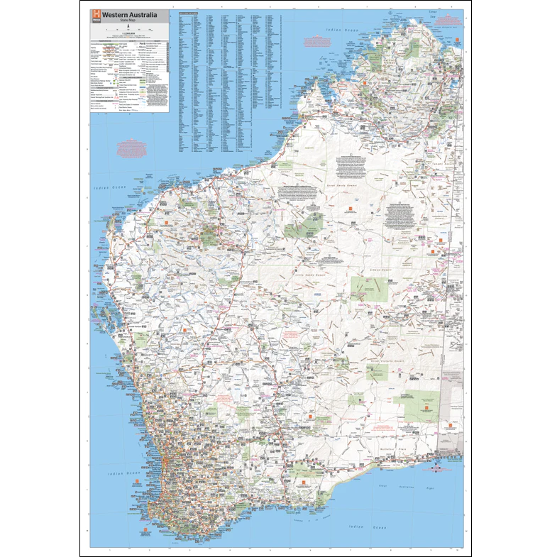
Description Western Australia State Wall Map 670 Explore the vast beauty of Western Australia with this detailed Western Australia State Wall Map, featuring a large-scale inset of the South West region at 1:1,870,000. Coverage includes key destinations from Lancelin and Kalgoorlie-Boulder in the north, down to Albany in the south, and out to Norseman and Esperance in the east. Designed for both travellers and professionals, this map clearly highlights: Dual carriageways, national highways, and major road routes Distances between towns and clearly marked route numbers Towns with size indicators and a comprehensive index of towns, localities, and homesteads Visitor Information Centres, deserts, reserves, national parks, and marine parks Whether you’re planning a road trip, navigating for work, or exploring the outback, this easy-to-read map is an essential companion. Printed on-demand on high-quality 180gsm paper stock, with laminating available.